 vesseltracker.com
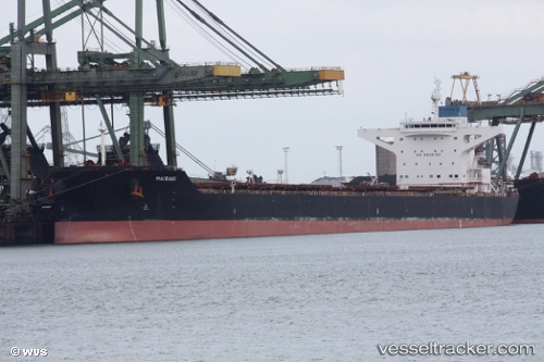
Vessel Mairaki IMO: 9444546, MMSI: 538004073 Bulk Carrier
UTC, -0.32167, 117.69667, course: -1, speed: 0
UTC, -0.31833, 117.69500, course: -1, speed: 0
2026-02-22 09:29:19 UTC, -0.31960, 117.69374, course: 142, speed: 0
Live AIS position:
UTC. 16 nm SE of Santan Terminal),
updated 2026-02-22 09:29:19 UTC.
Find the position of the vessel Mairaki on the map. The latter are known coordinates and path.
marine traffic ship tracker show on live map
The current position of vessel Mairaki is -0.31960 lat / 117.69374 lng. Updated: 2026-02-22 09:29:19 UTCCurrently sailing under the flag of Marshall Is
Mairaki built in 2011 year
Deadweight:
181483 tDetails:
Last coordinates of the vessel:
UTC, -0.32167, 117.69667, course: -1, speed: 0UTC, -0.32167, 117.69667, course: -1, speed: 0
UTC, -0.31833, 117.69500, course: -1, speed: 0
2026-02-22 09:29:19 UTC, -0.31960, 117.69374, course: 142, speed: 0