 vesseltracker.com
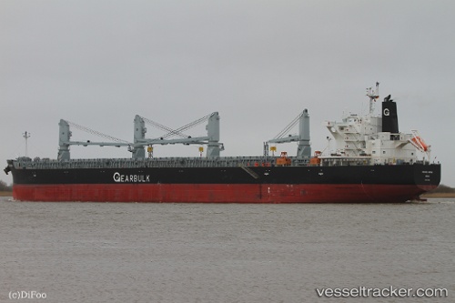
Vessel Maitaca Arrow IMO: 9515228, MMSI: 311000092 Bulk Carrier
UTC, -37.18565, 32.73933, course: 63, speed: 10.9
UTC, -37.13126, 32.98765, course: 72, speed: 11
2026-02-22 11:50:19 UTC, -37.07406, 33.50628, course: 79, speed: 11.1
Live AIS position:
UTC. 367 nm SE of Gonubie),
updated 2026-02-22 11:50:19 UTC.
Find the position of the vessel Maitaca Arrow on the map. The latter are known coordinates and path.
marine traffic ship tracker show on live map
The current position of vessel Maitaca Arrow is -37.07406 lat / 33.50628 lng. Updated: 2026-02-22 11:50:19 UTCDetails:
Last coordinates of the vessel:
UTC, -37.25807, 32.27127, course: 73, speed: 10.7UTC, -37.18565, 32.73933, course: 63, speed: 10.9
UTC, -37.13126, 32.98765, course: 72, speed: 11
2026-02-22 11:50:19 UTC, -37.07406, 33.50628, course: 79, speed: 11.1