 vesseltracker.com
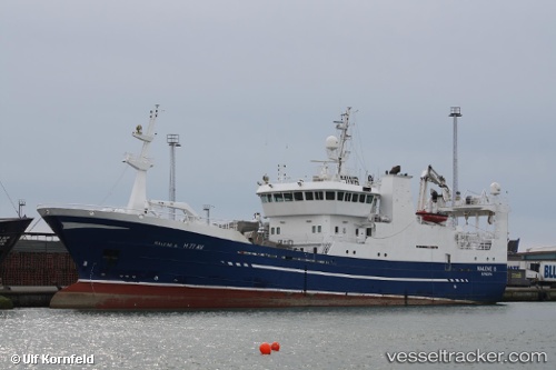
Vessel Malene S IMO: 9213973, MMSI: 257327000 Fish Carrier
UTC, 54.40406, -9.78282, course: 79, speed: 11.7
UTC, 54.46495, -9.34091, course: 78, speed: 12
2026-02-23 14:15:23 UTC, 54.62618, -8.43750, course: 19, speed: 0.2
Live AIS position:
UTC. Near KILLYBEGS),
updated 2026-02-23 14:15:23 UTC.
Find the position of the vessel Malene S on the map. The latter are known coordinates and path.
marine traffic ship tracker show on live map
The current position of vessel Malene S is 54.62618 lat / -8.43750 lng. Updated: 2026-02-23 14:15:23 UTCCurrently sailing under the flag of Norway
Malene S built in 2000 year
Deadweight:
2500 tDetails:
Last coordinates of the vessel:
UTC, 54.34092, -10.20286, course: 74, speed: 11.4UTC, 54.40406, -9.78282, course: 79, speed: 11.7
UTC, 54.46495, -9.34091, course: 78, speed: 12
2026-02-23 14:15:23 UTC, 54.62618, -8.43750, course: 19, speed: 0.2