 vesseltracker.com
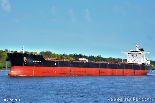
Vessel Malindi IMO: 9363015, MMSI: 256924000 Bulk Carrier
UTC, -23.70772, 52.86427, course: 245, speed: 10.2
UTC, -23.92710, 52.44537, course: 227, speed: 11.2
2026-02-23 20:29:59 UTC, -24.14833, 52.01667, course: -1, speed: 11
Live AIS position:
UTC. 251 nm SE of Manakara),
updated 2026-02-23 20:29:59 UTC.
Find the position of the vessel Malindi on the map. The latter are known coordinates and path.
marine traffic ship tracker show on live map
The current position of vessel Malindi is -24.14833 lat / 52.01667 lng. Updated: 2026-02-23 20:29:59 UTCCurrently sailing under the flag of Malta
Malindi built in 2008 year
Deadweight:
177987 tDetails:
Last coordinates of the vessel:
UTC, -23.56667, 53.13667, course: -1, speed: 11UTC, -23.70772, 52.86427, course: 245, speed: 10.2
UTC, -23.92710, 52.44537, course: 227, speed: 11.2
2026-02-23 20:29:59 UTC, -24.14833, 52.01667, course: -1, speed: 11