 vesseltracker.com
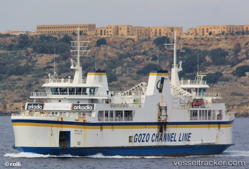
Vessel Malita IMO: 9176321, MMSI: 215145000 Passenger Ro Ro Cargo Ship
UTC, 36.024, 14.2994, course: 50, speed: 0
UTC, 36.0241, 14.2994, course: 48, speed: 0
2026-02-24 11:48:27 UTC, 36.0024, 14.3195, course: 157, speed: 11.9
Live AIS position:
UTC. Near CIRKEWWA),
updated 2026-02-24 11:48:27 UTC.
Find the position of the vessel Malita on the map. The latter are known coordinates and path.
marine traffic ship tracker show on live map
The current position of vessel Malita is 36.0024 lat / 14.3195 lng. Updated: 2026-02-24 11:48:27 UTCCurrently sailing under the flag of Malta
Malita built in 2002 year
Deadweight:
1100 tDetails:
Last coordinates of the vessel:
UTC, 35.9892, 14.3299, course: 47, speed: 0UTC, 36.024, 14.2994, course: 50, speed: 0
UTC, 36.0241, 14.2994, course: 48, speed: 0
2026-02-24 11:48:27 UTC, 36.0024, 14.3195, course: 157, speed: 11.9