 vesseltracker.com
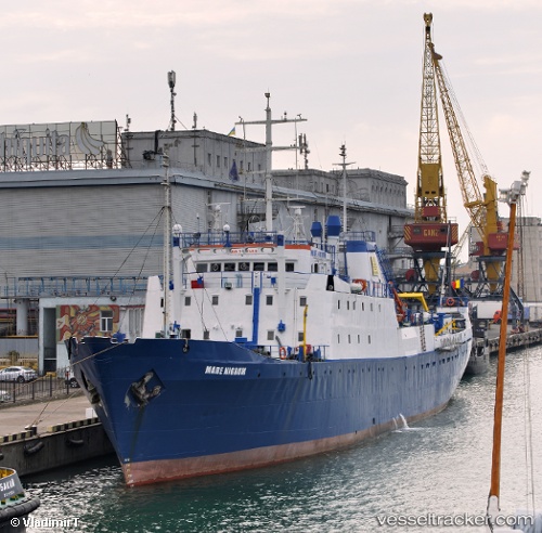
Vessel Mare Nigrum IMO: 7119408, MMSI: 264900062 Fishing Vessel
UTC, 43.97051, 28.98347, course: -1, speed: 6.9
UTC, 44.03039, 28.91677, course: -1, speed: 0
2026-03-01 15:00:12 UTC, 44.03039, 28.91677, course: -1, speed: 0
Live AIS position:
UTC. 12 nm E of Eforie Sud),
updated 2026-03-01 15:00:12 UTC.
Find the position of the vessel Mare Nigrum on the map. The latter are known coordinates and path.
marine traffic ship tracker show on live map
The current position of vessel Mare Nigrum is 44.03039 lat / 28.91677 lng. Updated: 2026-03-01 15:00:12 UTCCurrently sailing under the flag of Romania
Mare Nigrum built in 1971 year
Deadweight:
1138 tDetails:
Last coordinates of the vessel:
UTC, 43.85170, 29.11680, course: -1, speed: 7.3UTC, 43.97051, 28.98347, course: -1, speed: 6.9
UTC, 44.03039, 28.91677, course: -1, speed: 0
2026-03-01 15:00:12 UTC, 44.03039, 28.91677, course: -1, speed: 0