 vesseltracker.com
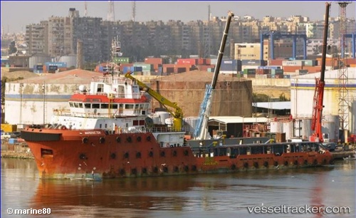
Vessel Maridive 704 IMO: 9603788, MMSI: 312652000 Offshore Tug Supply Ship
UTC, 32.90670, 13.18877, course: -1, speed: 0
UTC, 32.97664, 13.18506, course: -1, speed: 0.1
2026-03-03 17:47:10 UTC, 32.97621, 13.18454, course: 133, speed: 0.3
Live AIS position:
UTC. Near Tarabulus),
updated 2026-03-03 17:47:10 UTC.
Find the position of the vessel Maridive 704 on the map. The latter are known coordinates and path.
marine traffic ship tracker show on live map
The current position of vessel Maridive 704 is 32.97621 lat / 13.18454 lng. Updated: 2026-03-03 17:47:10 UTCCurrently sailing under the flag of Belize
Details:
Last coordinates of the vessel:
UTC, 32.90675, 13.18867, course: -1, speed: 0UTC, 32.90670, 13.18877, course: -1, speed: 0
UTC, 32.97664, 13.18506, course: -1, speed: 0.1
2026-03-03 17:47:10 UTC, 32.97621, 13.18454, course: 133, speed: 0.3