 vesseltracker.com
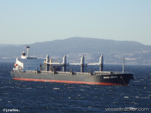
Vessel Marie Grace IMO: 9460332, MMSI: 636014046 Bulk Carrier
UTC, 14.06043, -35.45183, course: 225, speed: 9.8
UTC, 13.92505, -35.59440, course: 227, speed: 9.9
2026-03-04 02:31:50 UTC, 13.58175, -35.97845, course: 224, speed: 9.9
Live AIS position:
UTC. Open sea (no nearby ports in database)),
updated 2026-03-04 02:31:50 UTC.
Find the position of the vessel Marie Grace on the map. The latter are known coordinates and path.
marine traffic ship tracker show on live map
The current position of vessel Marie Grace is 13.58175 lat / -35.97845 lng. Updated: 2026-03-04 02:31:50 UTCDetails:
Last coordinates of the vessel:
UTC, 14.35858, -35.11393, course: 228, speed: 9.9UTC, 14.06043, -35.45183, course: 225, speed: 9.8
UTC, 13.92505, -35.59440, course: 227, speed: 9.9
2026-03-04 02:31:50 UTC, 13.58175, -35.97845, course: 224, speed: 9.9