 vesseltracker.com
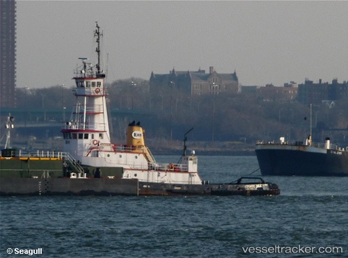
Vessel Marie H IMO: 7716969, MMSI: 368034790 Tug
UTC, 47.53667, -122.32833, course: -1, speed: 0
UTC, 47.53667, -122.32833, course: -1, speed: 0
2026-03-03 21:27:23 UTC, 47.53771, -122.32864, course: 138, speed: 0
Live AIS position:
UTC. Near Boeing Field Apt),
updated 2026-03-03 21:27:23 UTC.
Find the position of the vessel Marie H on the map. The latter are known coordinates and path.
marine traffic ship tracker show on live map
The current position of vessel Marie H is 47.53771 lat / -122.32864 lng. Updated: 2026-03-03 21:27:23 UTCCurrently sailing under the flag of USA
Marie H built in 1978 year
Details:
Last coordinates of the vessel:
UTC, 47.53775, -122.32862, course: 137, speed: 0UTC, 47.53667, -122.32833, course: -1, speed: 0
UTC, 47.53667, -122.32833, course: -1, speed: 0
2026-03-03 21:27:23 UTC, 47.53771, -122.32864, course: 138, speed: 0