 vesseltracker.com
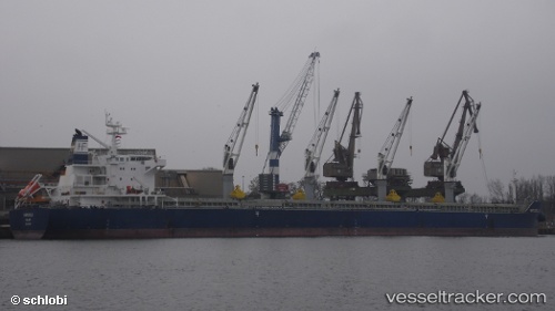
Vessel Marigoula IMO: 9617662, MMSI: 538005001 Bulk Carrier
UTC, 1.52315, 57.90496, course: 39, speed: 9.5
UTC, 1.92730, 58.13119, course: 37, speed: 9.7
2026-03-04 14:45:34 UTC, 2.02549, 58.18655, course: 36, speed: 9.7
Live Vessel Marigoula Analytics (details, animations, etc.)
Live AIS position: UTC. 348 nm NW of Akpo), updated 2026-03-04 14:45:34 UTC.Find the position of the vessel Marigoula on the map. The latter are known coordinates and path.
marine traffic ship tracker show on live map
The current position of vessel Marigoula is 2.02549 lat / 58.18655 lng. Updated: 2026-03-04 14:45:34 UTCDetails:
Last coordinates of the vessel:
UTC, 1.24566, 57.75516, course: 37, speed: 9.8UTC, 1.52315, 57.90496, course: 39, speed: 9.5
UTC, 1.92730, 58.13119, course: 37, speed: 9.7
2026-03-04 14:45:34 UTC, 2.02549, 58.18655, course: 36, speed: 9.7