 vesseltracker.com
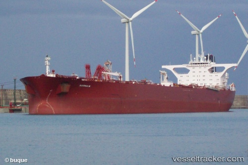
Vessel Marina M IMO: 9181194, MMSI: 249022000 Crude Oil Tanker
UTC, 51.88719, 4.37705, course: 282, speed: 0.1
UTC, 51.88719, 4.37707, course: 284, speed: 0.1
2026-03-04 05:43:31 UTC, 51.88719, 4.37704, course: -1, speed: 0.2
Live AIS position:
UTC. Near ROTTERDAM PERNIS),
updated 2026-03-04 05:43:31 UTC.
Find the position of the vessel Marina M on the map. The latter are known coordinates and path.
marine traffic ship tracker show on live map
The current position of vessel Marina M is 51.88719 lat / 4.37704 lng. Updated: 2026-03-04 05:43:31 UTCDetails:
Last coordinates of the vessel:
UTC, 51.88715, 4.37708, course: 282, speed: 0UTC, 51.88719, 4.37705, course: 282, speed: 0.1
UTC, 51.88719, 4.37707, course: 284, speed: 0.1
2026-03-04 05:43:31 UTC, 51.88719, 4.37704, course: -1, speed: 0.2