 vesseltracker.com
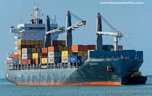
Vessel Mariner IMO: 9694414, MMSI: 563417000 Container Ship
UTC, 16.20551, -101.42484, course: 52, speed: 1.2
UTC, 16.17658, -101.40206, course: 44, speed: 0.8
2026-03-04 12:05:51 UTC, 16.14743, -101.37760, course: 48, speed: 1.1
Live Vessel Mariner Analytics (details, animations, etc.)
Live AIS position: UTC. 77 nm SW of Tecpan de Geleana), updated 2026-03-04 12:05:51 UTC.Find the position of the vessel Mariner on the map. The latter are known coordinates and path.
marine traffic ship tracker show on live map
The current position of vessel Mariner is 16.14743 lat / -101.37760 lng. Updated: 2026-03-04 12:05:51 UTCCurrently sailing under the flag of Singapore
Details:
Last coordinates of the vessel:
UTC, 16.22747, -101.44589, course: 43, speed: 1.3UTC, 16.20551, -101.42484, course: 52, speed: 1.2
UTC, 16.17658, -101.40206, course: 44, speed: 0.8
2026-03-04 12:05:51 UTC, 16.14743, -101.37760, course: 48, speed: 1.1