 vesseltracker.com
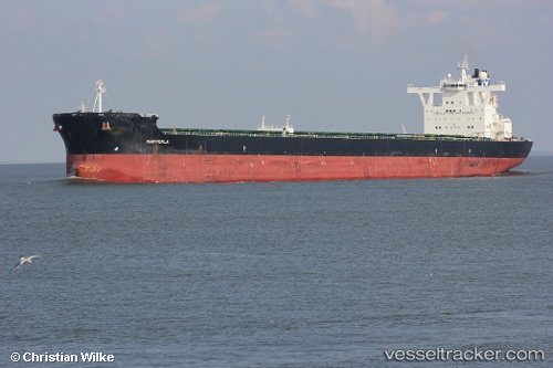
Vessel Mariperla IMO: 9447017, MMSI: 248134000 Bulk Carrier
UTC, 29.52067, 123.28282, course: 182, speed: 12.3
UTC, 29.02558, 123.25946, course: 173, speed: 10.3
2026-03-05 02:08:36 UTC, 28.72005, 123.23359, course: 184, speed: 10.5
Live Vessel Mariperla Analytics (details, animations, etc.)
Live AIS position: UTC. 68 nm E of Wenling Longmen Port), updated 2026-03-05 02:08:36 UTC.Find the position of the vessel Mariperla on the map. The latter are known coordinates and path.
marine traffic ship tracker show on live map
The current position of vessel Mariperla is 28.72005 lat / 123.23359 lng. Updated: 2026-03-05 02:08:36 UTCCurrently sailing under the flag of Malta
Mariperla built in 2009 year
Deadweight:
179759 tDetails:
Last coordinates of the vessel:
UTC, 29.80105, 123.35064, course: 190, speed: 12.7UTC, 29.52067, 123.28282, course: 182, speed: 12.3
UTC, 29.02558, 123.25946, course: 173, speed: 10.3
2026-03-05 02:08:36 UTC, 28.72005, 123.23359, course: 184, speed: 10.5