 vesseltracker.com
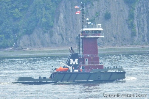
Vessel Mariya Moran IMO: 9764128, MMSI: 338305000 Tug
UTC, 28.32667, -86.82000, course: -1, speed: 10
UTC, 28.32667, -86.82000, course: -1, speed: 10
2026-03-04 15:49:34 UTC, 28.32667, -86.82000, course: -1, speed: 10
Live Vessel Mariya Moran Analytics (details, animations, etc.)
Live AIS position: UTC. 119 nm SW of Port Saint Joe), updated 2026-03-04 15:49:34 UTC.Find the position of the vessel Mariya Moran on the map. The latter are known coordinates and path.
marine traffic ship tracker show on live map
The current position of vessel Mariya Moran is 28.32667 lat / -86.82000 lng. Updated: 2026-03-04 15:49:34 UTCCurrently sailing under the flag of USA
Details:
Last coordinates of the vessel:
UTC, 28.29333, -86.39333, course: -1, speed: 10UTC, 28.32667, -86.82000, course: -1, speed: 10
UTC, 28.32667, -86.82000, course: -1, speed: 10
2026-03-04 15:49:34 UTC, 28.32667, -86.82000, course: -1, speed: 10