 vesseltracker.com
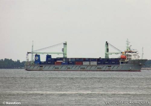
Vessel Meratus Barito IMO: 9458547, MMSI: 525025043 Deck Cargo Ship
UTC, -5.16667, 109.91833, course: -1, speed: 5
UTC, -5.33667, 109.93500, course: -1, speed: 5
2026-03-01 10:04:44 UTC, -5.54500, 109.95667, course: -1, speed: 5
Live AIS position:
UTC. 71 nm NW of TANJUNG JATI),
updated 2026-03-01 10:04:44 UTC.
Find the position of the vessel Meratus Barito on the map. The latter are known coordinates and path.
marine traffic ship tracker show on live map
The current position of vessel Meratus Barito is -5.54500 lat / 109.95667 lng. Updated: 2026-03-01 10:04:44 UTCDetails:
Last coordinates of the vessel:
UTC, -4.97333, 109.89833, course: -1, speed: 6UTC, -5.16667, 109.91833, course: -1, speed: 5
UTC, -5.33667, 109.93500, course: -1, speed: 5
2026-03-01 10:04:44 UTC, -5.54500, 109.95667, course: -1, speed: 5