 vesseltracker.com
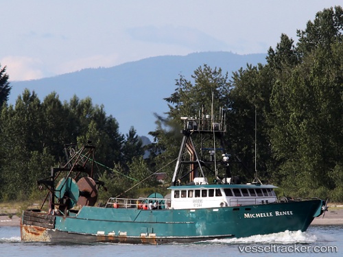
Vessel Michelle Renee IMO: 8852306, MMSI: 366747250 Fishing Vessel
UTC, 57.78806, -152.40022, course: 241, speed: 0
UTC, 57.78805, -152.40021, course: 240, speed: 0
2026-02-24 12:35:48 UTC, 57.78803, -152.40025, course: 241, speed: 0
Live AIS position:
UTC. Near Kodiak),
updated 2026-02-24 12:35:48 UTC.
Find the position of the vessel Michelle Renee on the map. The latter are known coordinates and path.
marine traffic ship tracker show on live map
The current position of vessel Michelle Renee is 57.78803 lat / -152.40025 lng. Updated: 2026-02-24 12:35:48 UTCDetails:
Last coordinates of the vessel:
UTC, 57.78581, -152.40631, course: 250, speed: 0UTC, 57.78806, -152.40022, course: 241, speed: 0
UTC, 57.78805, -152.40021, course: 240, speed: 0
2026-02-24 12:35:48 UTC, 57.78803, -152.40025, course: 241, speed: 0