 vesseltracker.com
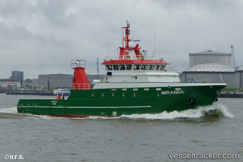
Vessel Miranda IMO: 9738258, MMSI: 311000554 Utility Vessel
Live AIS position:
UTC. Near IJmuiden/Velsen),
updated 2023-10-30 07:42:03 UTC.
Find the position of the vessel Miranda on the map. The latter are known coordinates and path.
marine traffic ship tracker show on live map
The current position of vessel Miranda is 52.45891 lat / 4.59109 lng. Updated: 2023-10-30 07:42:03 UTCCurrently sailing under the flag of Bahamas
Details:
Last coordinates of the vessel:
2023-10-30 07:42:03 UTC, 52.45891, 4.59109, course: -1, speed: 0