 vesseltracker.com
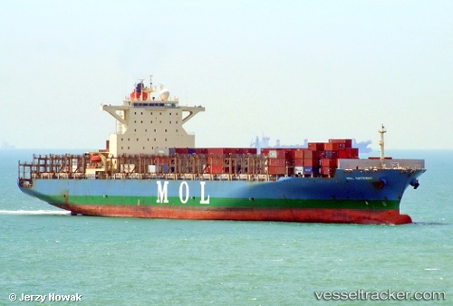
Vessel Mol Gateway IMO: 9535137, MMSI: 255805589 Container Ship
UTC, 9.62816, 107.27172, course: 64, speed: 0.2
UTC, 9.62883, 107.27157, course: 70, speed: 0.3
2026-02-08 11:49:41 UTC, 9.62667, 107.27167, course: -1, speed: 0
Live AIS position:
UTC. 45 nm S of Cape St. Jacques),
updated 2026-02-08 11:49:41 UTC.
Find the position of the vessel Mol Gateway on the map. The latter are known coordinates and path.
marine traffic ship tracker show on live map
The current position of vessel Mol Gateway is 9.62667 lat / 107.27167 lng. Updated: 2026-02-08 11:49:41 UTCCurrently sailing under the flag of Portugal
Mol Gateway built in 2011 year
Deadweight:
71429 tDetails:
Last coordinates of the vessel:
UTC, 9.62667, 107.27167, course: -1, speed: 0UTC, 9.62816, 107.27172, course: 64, speed: 0.2
UTC, 9.62883, 107.27157, course: 70, speed: 0.3
2026-02-08 11:49:41 UTC, 9.62667, 107.27167, course: -1, speed: 0