 vesseltracker.com
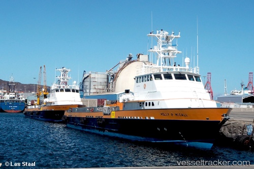
Vessel Molly R Mccall IMO: 9715335, MMSI: 538007648 Offshore Tug Supply Ship
UTC, 27.78245, 49.21851, course: 230, speed: 9.5
UTC, 27.77377, 48.91831, course: 106, speed: 0.1
2026-02-08 19:26:51 UTC, 27.77450, 48.91611, course: 142, speed: 0.2
Live AIS position:
UTC. 19 nm NW of Ras Al Khair),
updated 2026-02-08 19:26:51 UTC.
Find the position of the vessel Molly R Mccall on the map. The latter are known coordinates and path.
marine traffic ship tracker show on live map
The current position of vessel Molly R Mccall is 27.77450 lat / 48.91611 lng. Updated: 2026-02-08 19:26:51 UTCDetails:
Last coordinates of the vessel:
UTC, 28.03167, 49.43167, course: -1, speed: 10UTC, 27.78245, 49.21851, course: 230, speed: 9.5
UTC, 27.77377, 48.91831, course: 106, speed: 0.1
2026-02-08 19:26:51 UTC, 27.77450, 48.91611, course: 142, speed: 0.2