 vesseltracker.com
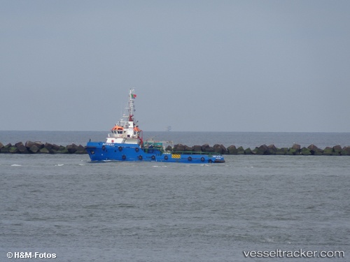
Vessel Monte Da Luz IMO: 9710153, MMSI: 263429550 Tug
UTC, 38.61928, -9.78396, course: -1, speed: 5.8
UTC, 38.82158, -9.83180, course: -1, speed: 6.1
2026-02-22 03:32:34 UTC, 38.91452, -9.82748, course: -1, speed: 5.9
Live AIS position:
UTC. 18 nm W of Azenhas do Mar),
updated 2026-02-22 03:32:34 UTC.
Find the position of the vessel Monte Da Luz on the map. The latter are known coordinates and path.
marine traffic ship tracker show on live map
The current position of vessel Monte Da Luz is 38.91452 lat / -9.82748 lng. Updated: 2026-02-22 03:32:34 UTCCurrently sailing under the flag of Portugal
Monte Da Luz built in 2013 year
Deadweight:
400 tDetails:
Last coordinates of the vessel:
UTC, 38.51812, -9.60379, course: -1, speed: 5.8UTC, 38.61928, -9.78396, course: -1, speed: 5.8
UTC, 38.82158, -9.83180, course: -1, speed: 6.1
2026-02-22 03:32:34 UTC, 38.91452, -9.82748, course: -1, speed: 5.9