 vesseltracker.com
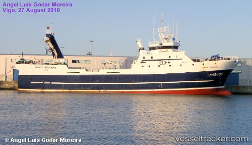
Vessel Monte Meixueiro IMO: 9329227, MMSI: 224298000 Fishing Vessel
Live AIS position:
UTC. 91 nm W of Baroville),
updated 2026-01-03 17:22:00 UTC.
Find the position of the vessel Monte Meixueiro on the map. The latter are known coordinates and path.
marine traffic ship tracker show on live map
The current position of vessel Monte Meixueiro is 48.19833 lat / -46.84833 lng. Updated: 2026-01-03 17:22:00 UTCCurrently sailing under the flag of Spain
Monte Meixueiro built in 2005 year
Deadweight:
545 tDetails:
Last coordinates of the vessel:
2026-01-03 17:22:00 UTC, 48.19833, -46.84833, course: -1, speed: 3