 vesseltracker.com
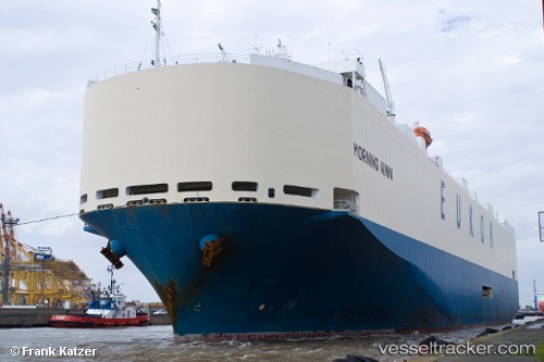
Vessel MORNING NINNI IMO: 9367592, MMSI: 440334000 Vehicles Carrier
UTC, 9.66333, 143.28333, course: -1, speed: 15
UTC, 10.17500, 143.20332, course: -1, speed: 15
2026-02-28 23:46:44 UTC, 10.64691, 143.13068, course: 357, speed: 15.3
Live AIS position:
UTC. 158 nm NW of Gaferut Atoll),
updated 2026-02-28 23:46:44 UTC.
Find the position of the vessel MORNING NINNI on the map. The latter are known coordinates and path.
marine traffic ship tracker show on live map
The current position of vessel MORNING NINNI is 10.64691 lat / 143.13068 lng. Updated: 2026-02-28 23:46:44 UTCCurrently sailing under the flag of South Korea
Details:
Last coordinates of the vessel:
UTC, 9.23167, 143.34833, course: -1, speed: 15UTC, 9.66333, 143.28333, course: -1, speed: 15
UTC, 10.17500, 143.20332, course: -1, speed: 15
2026-02-28 23:46:44 UTC, 10.64691, 143.13068, course: 357, speed: 15.3