 vesseltracker.com
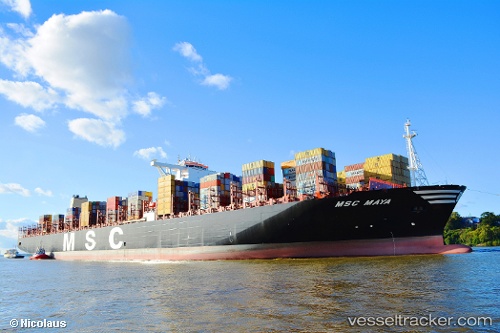
Vessel Msc Maya IMO: 9708679, MMSI: 374859000 Container Ship
UTC, 11.95333, 109.84667, course: -1, speed: 13
UTC, 11.61333, 109.96667, course: -1, speed: 13
2026-03-14 07:13:49 UTC, 11.24667, 109.97833, course: -1, speed: 14
Live Vessel Msc Maya Analytics (details, animations, etc.)
Live AIS position: UTC. 62 nm E of Phan Rang-Tháp Chàm), updated 2026-03-14 07:13:49 UTC.Find the position of the vessel Msc Maya on the map. The latter are known coordinates and path.
marine traffic ship tracker show on live map
The current position of vessel Msc Maya is 11.24667 lat / 109.97833 lng. Updated: 2026-03-14 07:13:49 UTCCurrently sailing under the flag of Panama
Details:
Last coordinates of the vessel:
UTC, 12.51733, 109.68341, course: 177, speed: 13.4UTC, 11.95333, 109.84667, course: -1, speed: 13
UTC, 11.61333, 109.96667, course: -1, speed: 13
2026-03-14 07:13:49 UTC, 11.24667, 109.97833, course: -1, speed: 14