 vesseltracker.com
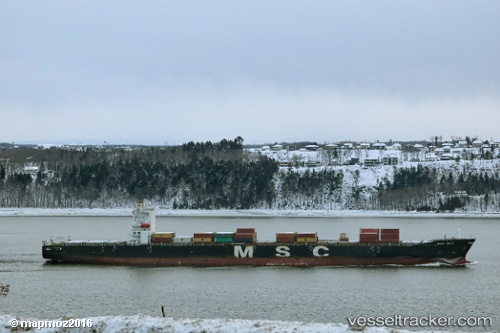
Vessel Msc Ela IMO: 9282259, MMSI: 353934000 Container Ship
UTC, 51.96072, 1.29440, course: 126, speed: 0
UTC, 51.96073, 1.29441, course: 126, speed: 0
2026-03-01 14:04:45 UTC, 51.96073, 1.29439, course: 126, speed: 0
Live AIS position:
UTC. Near SHOTLEY),
updated 2026-03-01 14:04:45 UTC.
Find the position of the vessel Msc Ela on the map. The latter are known coordinates and path.
marine traffic ship tracker show on live map
The current position of vessel Msc Ela is 51.96073 lat / 1.29439 lng. Updated: 2026-03-01 14:04:45 UTCCurrently sailing under the flag of Panama
Msc Ela built in 2004 year
Deadweight:
68307 tDetails:
Last coordinates of the vessel:
UTC, 51.96073, 1.29439, course: 125, speed: 0UTC, 51.96072, 1.29440, course: 126, speed: 0
UTC, 51.96073, 1.29441, course: 126, speed: 0
2026-03-01 14:04:45 UTC, 51.96073, 1.29439, course: 126, speed: 0