 vesseltracker.com
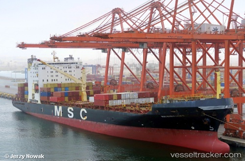
Vessel Msc Maria Laura IMO: 8616520, MMSI: 351634000 Container Ship
UTC, 29.52421, 48.86393, course: -1, speed: 13.1
UTC, 29.52421, 48.86393, course: -1, speed: 13.1
2026-02-28 15:21:33 UTC, 29.52421, 48.86393, course: -1, speed: 13.1
Live AIS position:
UTC. 14 nm S of Basrah Oil Terminal),
updated 2026-02-28 15:21:33 UTC.
Find the position of the vessel Msc Maria Laura on the map. The latter are known coordinates and path.
marine traffic ship tracker show on live map
The current position of vessel Msc Maria Laura is 29.52421 lat / 48.86393 lng. Updated: 2026-02-28 15:21:33 UTCDetails:
Last coordinates of the vessel:
UTC, 29.73304, 48.62926, course: 116, speed: 7.9UTC, 29.52421, 48.86393, course: -1, speed: 13.1
UTC, 29.52421, 48.86393, course: -1, speed: 13.1
2026-02-28 15:21:33 UTC, 29.52421, 48.86393, course: -1, speed: 13.1