 vesseltracker.com
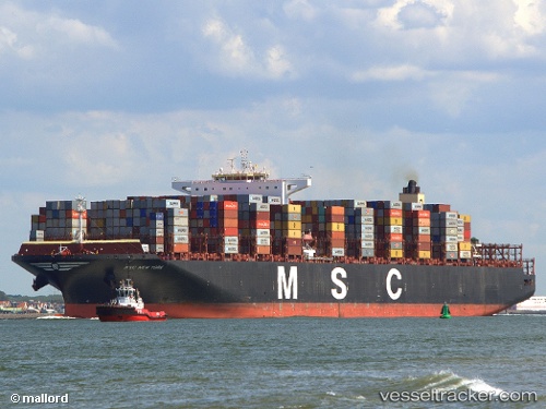
Vessel Msc Newyork IMO: 9606314, MMSI: 352952000 Container Ship
UTC, 43.97738, 9.82366, course: 55, speed: 0
UTC, 43.97776, 9.82343, course: 71, speed: 0
2026-03-01 05:50:57 UTC, 43.97763, 9.82344, course: 70, speed: 0
Live AIS position:
UTC. Near Portovenere),
updated 2026-03-01 05:50:57 UTC.
Find the position of the vessel Msc Newyork on the map. The latter are known coordinates and path.
marine traffic ship tracker show on live map
The current position of vessel Msc Newyork is 43.97763 lat / 9.82344 lng. Updated: 2026-03-01 05:50:57 UTCDetails:
Last coordinates of the vessel:
UTC, 43.97797, 9.82332, course: 81, speed: 0UTC, 43.97738, 9.82366, course: 55, speed: 0
UTC, 43.97776, 9.82343, course: 71, speed: 0
2026-03-01 05:50:57 UTC, 43.97763, 9.82344, course: 70, speed: 0