 vesseltracker.com
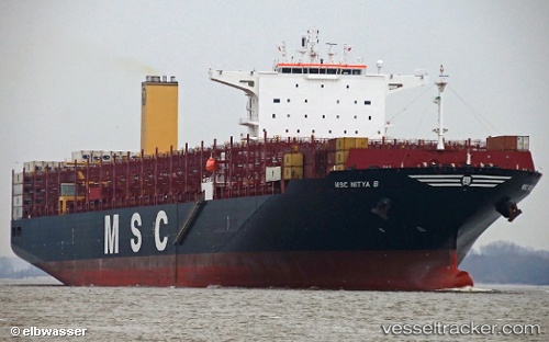
Vessel Msc Nitya B IMO: 9778117, MMSI: 255806029 Container Ship
UTC, 1.25412, 103.63139, course: 269, speed: 0
UTC, 1.25411, 103.63141, course: 269, speed: 0
2026-03-04 03:38:22 UTC, 1.25412, 103.63144, course: 269, speed: 0
Live AIS position:
UTC. Near JURONG ISLAND),
updated 2026-03-04 03:38:22 UTC.
Find the position of the vessel Msc Nitya B on the map. The latter are known coordinates and path.
marine traffic ship tracker show on live map
The current position of vessel Msc Nitya B is 1.25412 lat / 103.63144 lng. Updated: 2026-03-04 03:38:22 UTCCurrently sailing under the flag of Portugal
Details:
Last coordinates of the vessel:
UTC, 1.25411, 103.63144, course: 269, speed: 0UTC, 1.25412, 103.63139, course: 269, speed: 0
UTC, 1.25411, 103.63141, course: 269, speed: 0
2026-03-04 03:38:22 UTC, 1.25412, 103.63144, course: 269, speed: 0