 vesseltracker.com
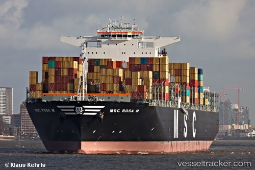
Vessel Msc Rosa M IMO: 9461398, MMSI: 354462000 Container Ship
UTC, 22.54102, 116.33462, course: 245, speed: 15.4
UTC, 22.31829, 115.81010, course: 244, speed: 15.7
2026-03-01 18:19:41 UTC, 22.02833, 115.11667, course: -1, speed: 15
Live AIS position:
UTC. 37 nm SE of Pinghai),
updated 2026-03-01 18:19:41 UTC.
Find the position of the vessel Msc Rosa M on the map. The latter are known coordinates and path.
marine traffic ship tracker show on live map
The current position of vessel Msc Rosa M is 22.02833 lat / 115.11667 lng. Updated: 2026-03-01 18:19:41 UTCDetails:
Last coordinates of the vessel:
UTC, 22.66543, 116.60726, course: 243, speed: 16.3UTC, 22.54102, 116.33462, course: 245, speed: 15.4
UTC, 22.31829, 115.81010, course: 244, speed: 15.7
2026-03-01 18:19:41 UTC, 22.02833, 115.11667, course: -1, speed: 15