 vesseltracker.com
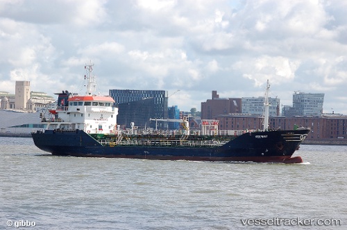
Vessel Mt Keewhit IMO: 9286504, MMSI: 235008440 Chemical Tanker
UTC, 53.57333, 0.44833, course: -1, speed: 0
UTC, 53.57535, 0.44822, course: -1, speed: 0.1
2026-02-26 03:45:06 UTC, 53.57500, 0.44667, course: -1, speed: 0
Live AIS position:
UTC. 10 nm SE of Withernsea),
updated 2026-02-26 03:45:06 UTC.
Find the position of the vessel Mt Keewhit on the map. The latter are known coordinates and path.
marine traffic ship tracker show on live map
The current position of vessel Mt Keewhit is 53.57500 lat / 0.44667 lng. Updated: 2026-02-26 03:45:06 UTCCurrently sailing under the flag of United Kingdom
Mt Keewhit built in 2003 year
Deadweight:
2332 tDetails:
Last coordinates of the vessel:
UTC, 53.57372, 0.44762, course: 310, speed: 0.1UTC, 53.57333, 0.44833, course: -1, speed: 0
UTC, 53.57535, 0.44822, course: -1, speed: 0.1
2026-02-26 03:45:06 UTC, 53.57500, 0.44667, course: -1, speed: 0