 vesseltracker.com
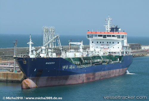
Vessel Mt Madeiro IMO: 9418913, MMSI: 215736000 Chemical Oil Products Tanker
UTC, 22.9524, 66.3326, course: -1, speed: 10.4
UTC, 23.175, 65.6717, course: -1, speed: 10
2026-02-26 15:08:40 UTC, 23.2441, 65.4591, course: 281, speed: 7.9
Live AIS position:
UTC. 121 nm SW of Keti Bandar),
updated 2026-02-26 15:08:40 UTC.
Find the position of the vessel Mt Madeiro on the map. The latter are known coordinates and path.
marine traffic ship tracker show on live map
The current position of vessel Mt Madeiro is 23.2441 lat / 65.4591 lng. Updated: 2026-02-26 15:08:40 UTCDetails:
Last coordinates of the vessel:
UTC, 22.9132, 66.4401, course: 290, speed: 10.7UTC, 22.9524, 66.3326, course: -1, speed: 10.4
UTC, 23.175, 65.6717, course: -1, speed: 10
2026-02-26 15:08:40 UTC, 23.2441, 65.4591, course: 281, speed: 7.9