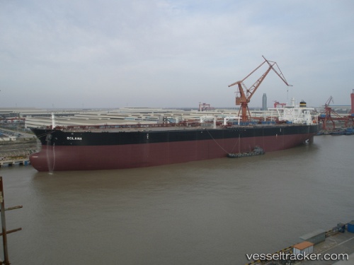
vessel Mt Solana IMO: 9395317, Crude Oil Tanker
vesseltracker.com
Vessel Mt Solana IMO: 9395317, Crude Oil Tanker
MMSI: 248330000 callsign: 9HA2320 size: 60x330

Find the position of the vessel Mt Solana on the map. The latter are known coordinates and path.

marine traffic ship tracker show on live map

The current position of vessel Mt Solana is 28.5605 lat / -94.6843 lng. Updated: 2025-02-03 07:06:36 UTC
Port of registry:
Valletta (capital of Malta)
Payload_mass:
296400 tonne
Gross tonnage:
156651
Service entry:
2010-01-01T00:00:00Z
Details:


Last coordinates of the vessel:
UTC, 28.5576, -94.6697, course: 73, speed: 0.2
UTC, 28.5573, -94.6763, course: 66, speed: 0.2
UTC, 28.5585, -94.6801, course: 90, speed: 0.1
2025-02-03 07:06:36 UTC, 28.5605, -94.6843, course: 83, speed: 0.2

Track of the vessel in the last 14 days


Most frequent ports a vessels calls at Mt Solana (248330000):

Urdiales, traffic: 4
Castro-Urdiales, traffic: 4
Port Said, traffic: 2
Puerto De La Luz, traffic: 2
Ras Gharib, traffic: 2
Strait Of Gibraltar, traffic: 2
Bilbao, traffic: 2
Wilhelmshaven, traffic: 2
Bur Ibrahim, traffic: 2
Las Palmas, traffic: 2
Maassluis, traffic: 1
Dakar, traffic: 1

Link to the map:


Find another ship

Mt_Solana (248330000) last ports (portcalls and passsages)

Dakar | 2024-03-05 17:56:18
Puerto De La Luz | 2022-06-16 07:43:50
Puerto De La Luz | 2022-05-08 10:14:43
Maassluis | 2022-04-14 03:46:00
Wilhelmshaven | 2022-04-07 06:20:57
Urdiales | 2022-04-02 12:06:28
Urdiales | 2022-04-02 09:40:59
Strait Of Gibraltar | 2022-01-11 20:55:18
Port Said | 2021-12-24 15:17:30
Bur Ibrahim | 2021-12-24 05:42:43
Ras Gharib | 2021-12-22 17:43:59