 vesseltracker.com
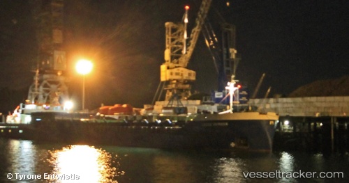
Vessel Muhammet Gumustas 6 IMO: 8509832, MMSI: 271046117 General Cargo Ship
UTC, 40.95774, 28.86309, course: -1, speed: 0
UTC, 40.95852, 28.86283, course: -1, speed: 0.1
2026-02-24 17:50:04 UTC, 40.95853, 28.86304, course: 132, speed: 0
Live AIS position:
UTC. Near BAKIRKOY),
updated 2026-02-24 17:50:04 UTC.
Find the position of the vessel Muhammet Gumustas 6 on the map. The latter are known coordinates and path.
marine traffic ship tracker show on live map
The current position of vessel Muhammet Gumustas 6 is 40.95853 lat / 28.86304 lng. Updated: 2026-02-24 17:50:04 UTCCurrently sailing under the flag of Turkey
Muhammet Gumustas 6 built in 1985 year
Deadweight:
3065 tDetails:
Last coordinates of the vessel:
UTC, 40.95772, 28.86310, course: 67, speed: 0.1UTC, 40.95774, 28.86309, course: -1, speed: 0
UTC, 40.95852, 28.86283, course: -1, speed: 0.1
2026-02-24 17:50:04 UTC, 40.95853, 28.86304, course: 132, speed: 0