 vesseltracker.com
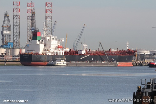
Vessel Muhut Silver IMO: 9718789, MMSI: 538006502 Chemical Oil Products Tanker
UTC, 32.45242, -161.62025, course: 267, speed: 11.9
UTC, 32.44482, -162.03374, course: 267, speed: 12
2026-02-26 22:36:07 UTC, 32.45528, -162.74249, course: 267, speed: 11.2
Live AIS position:
UTC. Open sea (no nearby ports in database)),
updated 2026-02-26 22:36:07 UTC.
Find the position of the vessel Muhut Silver on the map. The latter are known coordinates and path.
marine traffic ship tracker show on live map
The current position of vessel Muhut Silver is 32.45528 lat / -162.74249 lng. Updated: 2026-02-26 22:36:07 UTCDetails:
Last coordinates of the vessel:
UTC, 32.45222, -161.14192, course: 269, speed: 11.9UTC, 32.45242, -161.62025, course: 267, speed: 11.9
UTC, 32.44482, -162.03374, course: 267, speed: 12
2026-02-26 22:36:07 UTC, 32.45528, -162.74249, course: 267, speed: 11.2