 vesseltracker.com
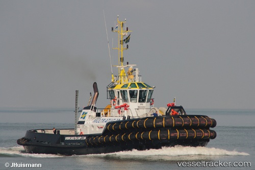
Vessel Multratug 19 IMO: 9630250, MMSI: 245875000 Tug
UTC, 54.63857, 11.37587, course: 26, speed: 0
UTC, 54.63830, 11.37414, course: 293, speed: 0
2026-02-22 01:58:21 UTC, 54.63839, 11.37401, course: 293, speed: 0
Live AIS position:
UTC. Near Rødbyhavn),
updated 2026-02-22 01:58:21 UTC.
Find the position of the vessel Multratug 19 on the map. The latter are known coordinates and path.
marine traffic ship tracker show on live map
The current position of vessel Multratug 19 is 54.63839 lat / 11.37401 lng. Updated: 2026-02-22 01:58:21 UTCCurrently sailing under the flag of Netherlands
Multratug 19 built in 2012 year
Deadweight:
226 tDetails:
Last coordinates of the vessel:
UTC, 54.63842, 11.38281, course: 96, speed: 0.1UTC, 54.63857, 11.37587, course: 26, speed: 0
UTC, 54.63830, 11.37414, course: 293, speed: 0
2026-02-22 01:58:21 UTC, 54.63839, 11.37401, course: 293, speed: 0