 vesseltracker.com
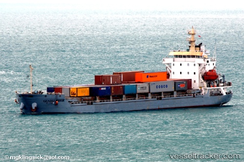
Vessel Mulya Sentosa Ii IMO: 9291054, MMSI: 525300044 Container Ship
UTC, 0.00824, 109.28025, course: -1, speed: 8.5
UTC, 0.00824, 109.28025, course: -1, speed: 8.5
2026-02-24 18:08:24 UTC, 0.00824, 109.28025, course: -1, speed: 8.5
Live AIS position:
UTC. Near PONTIANAK),
updated 2026-02-24 18:08:24 UTC.
Find the position of the vessel Mulya Sentosa Ii on the map. The latter are known coordinates and path.
marine traffic ship tracker show on live map
The current position of vessel Mulya Sentosa Ii is 0.00824 lat / 109.28025 lng. Updated: 2026-02-24 18:08:24 UTCDetails:
Last coordinates of the vessel:
UTC, 0.07674, 109.15575, course: -1, speed: 7.6UTC, 0.00824, 109.28025, course: -1, speed: 8.5
UTC, 0.00824, 109.28025, course: -1, speed: 8.5
2026-02-24 18:08:24 UTC, 0.00824, 109.28025, course: -1, speed: 8.5