 vesseltracker.com
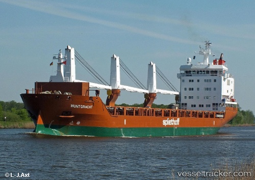
Vessel Muntgracht IMO: 9571545, MMSI: 246771000 General Cargo Ship
UTC, 36.83680, 5.84203, course: 0, speed: 0
UTC, 36.83696, 5.84136, course: 30, speed: 0
2026-02-24 17:31:24 UTC, 36.83726, 5.84092, course: 54, speed: 0
Live AIS position:
UTC. Near DJEN DJEN),
updated 2026-02-24 17:31:24 UTC.
Find the position of the vessel Muntgracht on the map. The latter are known coordinates and path.
marine traffic ship tracker show on live map
The current position of vessel Muntgracht is 36.83726 lat / 5.84092 lng. Updated: 2026-02-24 17:31:24 UTCCurrently sailing under the flag of Netherlands
Muntgracht built in 2012 year
Deadweight:
11744 tDetails:
Last coordinates of the vessel:
UTC, 36.83685, 5.84242, course: 352, speed: 0.1UTC, 36.83680, 5.84203, course: 0, speed: 0
UTC, 36.83696, 5.84136, course: 30, speed: 0
2026-02-24 17:31:24 UTC, 36.83726, 5.84092, course: 54, speed: 0