 vesseltracker.com
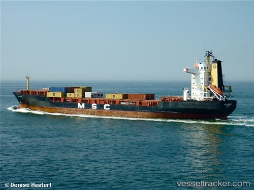
Vessel Mv Oriental Ruby IMO: 8902125, MMSI: 525015924 Container Ship
UTC, 3.79275, 98.71403, course: 226, speed: 0
UTC, 3.79278, 98.71408, course: 226, speed: 0
2026-02-22 10:22:31 UTC, 3.79275, 98.71405, course: 226, speed: 0.1
Live AIS position:
UTC. Near Belawan),
updated 2026-02-22 10:22:31 UTC.
Find the position of the vessel Mv Oriental Ruby on the map. The latter are known coordinates and path.
marine traffic ship tracker show on live map
The current position of vessel Mv Oriental Ruby is 3.79275 lat / 98.71405 lng. Updated: 2026-02-22 10:22:31 UTCCurrently sailing under the flag of Indonesia
Mv Oriental Ruby built in 1989 year
Deadweight:
26288 tDetails:
Last coordinates of the vessel:
UTC, 3.79276, 98.71412, course: 225, speed: 0.1UTC, 3.79275, 98.71403, course: 226, speed: 0
UTC, 3.79278, 98.71408, course: 226, speed: 0
2026-02-22 10:22:31 UTC, 3.79275, 98.71405, course: 226, speed: 0.1