 vesseltracker.com
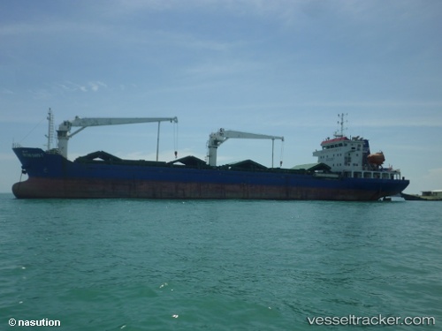
Vessel Mv.intan Daya 7 IMO: 9656967, MMSI: 525020078 General Cargo Ship
UTC, -6.01667, 116.70667, course: -1, speed: 5
UTC, -6.01500, 117.00667, course: -1, speed: 6
2026-02-21 11:40:54 UTC, -6.01667, 117.20167, course: -1, speed: 5
Live AIS position:
UTC. 94 nm NE of Pagerungan),
updated 2026-02-21 11:40:54 UTC.
Find the position of the vessel Mv.intan Daya 7 on the map. The latter are known coordinates and path.
marine traffic ship tracker show on live map
The current position of vessel Mv.intan Daya 7 is -6.01667 lat / 117.20167 lng. Updated: 2026-02-21 11:40:54 UTCDetails:
Last coordinates of the vessel:
UTC, -6.01667, 116.62500, course: -1, speed: 6UTC, -6.01667, 116.70667, course: -1, speed: 5
UTC, -6.01500, 117.00667, course: -1, speed: 6
2026-02-21 11:40:54 UTC, -6.01667, 117.20167, course: -1, speed: 5