 vesseltracker.com
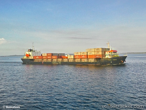
Vessel Mv.kali Mas IMO: 9562051, MMSI: 525019527 Container Ship
UTC, -6.48205, 113.30477, course: -1, speed: 5.4
UTC, -6.61810, 113.11318, course: -1, speed: 4.8
2026-02-21 12:23:24 UTC, -6.74760, 112.92722, course: -1, speed: 4.7
Live AIS position:
UTC. Near Poleng),
updated 2026-02-21 12:23:24 UTC.
Find the position of the vessel Mv.kali Mas on the map. The latter are known coordinates and path.
marine traffic ship tracker show on live map
The current position of vessel Mv.kali Mas is -6.74760 lat / 112.92722 lng. Updated: 2026-02-21 12:23:24 UTCDetails:
Last coordinates of the vessel:
UTC, -6.43287, 113.37574, course: -1, speed: 5.8UTC, -6.48205, 113.30477, course: -1, speed: 5.4
UTC, -6.61810, 113.11318, course: -1, speed: 4.8
2026-02-21 12:23:24 UTC, -6.74760, 112.92722, course: -1, speed: 4.7