 vesseltracker.com
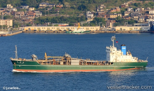
Vessel Mv.mandraguna IMO: 8710168, MMSI: 525119060 Cement Carrier
UTC, -8.26655, 115.99022, course: 9, speed: 10.1
UTC, -7.92833, 116.03167, course: -1, speed: 9
2026-02-21 12:25:13 UTC, -7.48333, 116.08500, course: -1, speed: 10
Live AIS position:
UTC. 25 nm SE of Sepanjang Terminal),
updated 2026-02-21 12:25:13 UTC.
Find the position of the vessel Mv.mandraguna on the map. The latter are known coordinates and path.
marine traffic ship tracker show on live map
The current position of vessel Mv.mandraguna is -7.48333 lat / 116.08500 lng. Updated: 2026-02-21 12:25:13 UTCCurrently sailing under the flag of Indonesia
Details:
Last coordinates of the vessel:
UTC, -8.53465, 115.98122, course: 1, speed: 10.3UTC, -8.26655, 115.99022, course: 9, speed: 10.1
UTC, -7.92833, 116.03167, course: -1, speed: 9
2026-02-21 12:25:13 UTC, -7.48333, 116.08500, course: -1, speed: 10