 vesseltracker.com
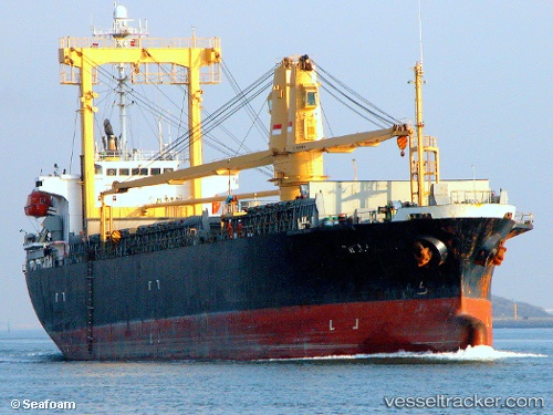
Vessel Mv.sinar Kudus IMO: 9172507, MMSI: 525009027 General Cargo Ship
Live AIS position:
UTC. 26 nm S of Dumai),
updated 2023-02-25 07:05:06 UTC.
Find the position of the vessel Mv.sinar Kudus on the map. The latter are known coordinates and path.
marine traffic ship tracker show on live map
The current position of vessel Mv.sinar Kudus is 1.26330 lat / 101.44488 lng. Updated: 2023-02-25 07:05:06 UTCCurrently sailing under the flag of Indonesia
Mv.sinar Kudus built in 1999 year
Deadweight:
8911 tDetails:
Last coordinates of the vessel:
2023-02-25 07:05:06 UTC, 1.26330, 101.44488, course: 0, speed: 0.1