 vesseltracker.com
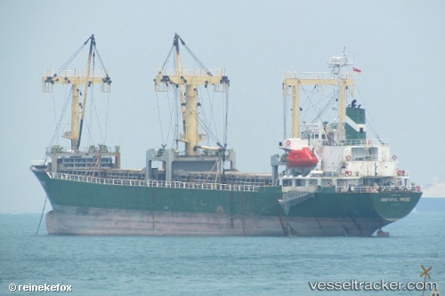
Vessel Mv.tunas Baru IMO: 9014482, MMSI: 525675000 Multi Purpose Carrier
UTC, 3.78354, 98.66077, course: -1, speed: 0.1
UTC, 3.78356, 98.66072, course: -1, speed: 0
2026-02-21 12:20:47 UTC, 3.78353, 98.66074, course: -1, speed: 0
Live AIS position:
UTC. Near Belawan),
updated 2026-02-21 12:20:47 UTC.
Find the position of the vessel Mv.tunas Baru on the map. The latter are known coordinates and path.
marine traffic ship tracker show on live map
The current position of vessel Mv.tunas Baru is 3.78353 lat / 98.66074 lng. Updated: 2026-02-21 12:20:47 UTCDetails:
Last coordinates of the vessel:
UTC, 3.78354, 98.66083, course: -1, speed: 0UTC, 3.78354, 98.66077, course: -1, speed: 0.1
UTC, 3.78356, 98.66072, course: -1, speed: 0
2026-02-21 12:20:47 UTC, 3.78353, 98.66074, course: -1, speed: 0