 vesseltracker.com
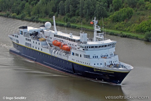
Vessel N G Explorer IMO: 8019356, MMSI: 309336000 Cruise Ship
UTC, -62.98309, -60.56023, course: 293, speed: 0.2
UTC, -62.98341, -60.56051, course: 309, speed: 0.5
2026-02-08 16:10:58 UTC, -62.80895, -60.12606, course: 40, speed: 10.4
Live AIS position:
UTC. 12 nm SE of Juan Carlos Primero),
updated 2026-02-08 16:10:58 UTC.
Find the position of the vessel N G Explorer on the map. The latter are known coordinates and path.
marine traffic ship tracker show on live map
The current position of vessel N G Explorer is -62.80895 lat / -60.12606 lng. Updated: 2026-02-08 16:10:58 UTCCurrently sailing under the flag of Bahamas
N G Explorer built in 1982 year
Deadweight:
1301 tDetails:
Last coordinates of the vessel:
UTC, -62.98580, -60.23889, course: 258, speed: 7.7UTC, -62.98309, -60.56023, course: 293, speed: 0.2
UTC, -62.98341, -60.56051, course: 309, speed: 0.5
2026-02-08 16:10:58 UTC, -62.80895, -60.12606, course: 40, speed: 10.4