 vesseltracker.com
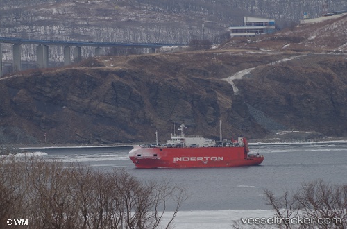
Vessel NEKSU IMO: 8907606, MMSI: 671864000 Vehicles Carrier
UTC, 33.91228, 131.05440, course: 344, speed: 0.1
UTC, 33.91202, 131.05421, course: 299, speed: 0.1
2026-02-08 22:05:30 UTC, 33.91234, 131.05435, course: 287, speed: 0.1
Live AIS position:
UTC. Near SHINMONJI),
updated 2026-02-08 22:05:30 UTC.
Find the position of the vessel NEKSU on the map. The latter are known coordinates and path.
marine traffic ship tracker show on live map
The current position of vessel NEKSU is 33.91234 lat / 131.05435 lng. Updated: 2026-02-08 22:05:30 UTCCurrently sailing under the flag of Togo
NEKSU built in 1989 year
Deadweight:
0 tDetails:
Last coordinates of the vessel:
UTC, 33.91237, 131.05443, course: 276, speed: 0.2UTC, 33.91228, 131.05440, course: 344, speed: 0.1
UTC, 33.91202, 131.05421, course: 299, speed: 0.1
2026-02-08 22:05:30 UTC, 33.91234, 131.05435, course: 287, speed: 0.1