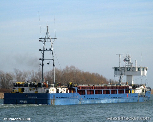
vessel NINOVA IMO: 8700072, General Cargo Ship vesseltracker.com
Vessel NINOVA IMO: 8700072, General Cargo Ship
MMSI: 620961000 callsign: D6A2969 size: x

Find the position of the vessel NINOVA on the map. The latter are known coordinates and path.

marine traffic ship tracker show on live map

The current position of vessel NINOVA is 41.2983 lat / 36.3674 lng. Updated: 2023-09-07 08:06:56 UTC

Currently sailing under the flag of Comoros

NINOVA built in 1989 year

Deadweight:
2541 t

Details:


Last coordinates of the vessel:
2023-09-07 08:06:56 UTC, 41.2983, 36.3674, course: 352, speed: 0

Track of the vessel in the last 14 days


Most frequent ports a vessels calls at NINOVA (620961000):

Istanbul, traffic: 12
Constanta, traffic: 9
Uskudar, traffic: 8
Poti, traffic: 6
Antalya, traffic: 4
Canakkale, traffic: 4
Varna, traffic: 3
Gelibolu, traffic: 2
Haifa, traffic: 2
Iskenderun, traffic: 2
Mitilini, traffic: 2
Rhodes, traffic: 2
Ashdod, traffic: 2
Samsun, traffic: 2
Famagusta, traffic: 2

Link to the map:


Find another ship

NINOVA (620961000) last ports (portcalls and passsages)

Constanta | 2022-05-26 07:24:07
Constanta | 2022-05-22 07:18:53
Constanta | 2022-05-02 12:21:40
Varna | 2022-04-17 21:30:01
Istanbul | 2022-04-17 00:45:08
Istanbul | 2022-04-16 18:27:02
Ashdod | 2022-04-06 16:05:17
Rhodes | 2022-04-04 15:35:01
Canakkale | 2022-03-25 21:20:01
Istanbul | 2022-03-25 03:45:06
Varna | 2022-03-16 12:47:10
Uskudar | 2022-03-15 15:20:04
Istanbul | 2022-03-13 15:46:37
Gelibolu | 2022-03-13 00:13:15
Canakkale | 2022-03-12 21:05:02
Mitilini | 2022-03-12 06:06:55
Iskenderun | 2022-03-01 03:10:11
Haifa | 2022-02-27 09:55:23
Antalya | 2022-02-23 18:10:04
Famagusta | 2022-02-13 12:46:37
Antalya | 2022-02-06 03:00:01
Uskudar | 2022-02-01 08:10:02
Constanta | 2022-01-23 02:40:15
Samsun | 2022-01-12 00:05:31
Poti | 2022-01-05 03:30:30
Constanta | 2021-12-29 13:30:06
Poti | 2021-12-19 11:56:55
Constanta | 2021-12-12 16:40:14
Poti | 2021-12-03 17:20:09