 vesseltracker.com
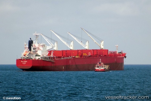
Vessel NOBLE ISLAND IMO: 9705316, MMSI: 477681400 Bulk Carrier
UTC, 24.10071, 158.35912, course: 112, speed: 10.7
UTC, 23.95333, 158.67166, course: -1, speed: 11
2026-02-08 19:44:55 UTC, 23.75611, 159.09045, course: 120, speed: 10.5
Live AIS position:
UTC. Open sea (no nearby ports in database)),
updated 2026-02-08 19:44:55 UTC.
Find the position of the vessel NOBLE ISLAND on the map. The latter are known coordinates and path.
marine traffic ship tracker show on live map
The current position of vessel NOBLE ISLAND is 23.75611 lat / 159.09045 lng. Updated: 2026-02-08 19:44:55 UTCCurrently sailing under the flag of Hong Kong, China
NOBLE ISLAND built in 2015 year
Deadweight:
61115 tDetails:
Last coordinates of the vessel:
UTC, 24.27532, 157.98271, course: 115, speed: 10.7UTC, 24.10071, 158.35912, course: 112, speed: 10.7
UTC, 23.95333, 158.67166, course: -1, speed: 11
2026-02-08 19:44:55 UTC, 23.75611, 159.09045, course: 120, speed: 10.5