 vesseltracker.com
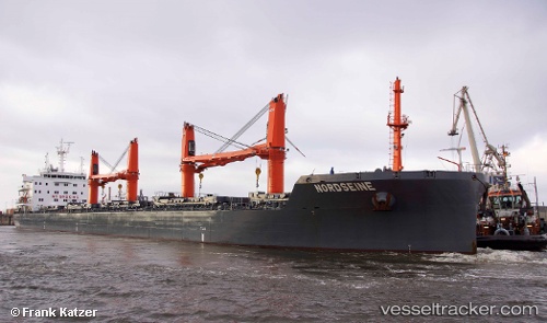
Vessel NORDSEINE IMO: 9596052, MMSI: 255806298 Bulk Carrier
UTC, 12.78500, -92.76500, course: -1, speed: 9
UTC, 12.71129, -92.60282, course: 110, speed: 9.9
2026-02-12 21:59:24 UTC, 12.53022, -92.19155, course: 114, speed: 10.3
Live AIS position:
UTC. 104 nm SW of Sipacate),
updated 2026-02-12 21:59:24 UTC.
Find the position of the vessel NORDSEINE on the map. The latter are known coordinates and path.
marine traffic ship tracker show on live map
The current position of vessel NORDSEINE is 12.53022 lat / -92.19155 lng. Updated: 2026-02-12 21:59:24 UTCCurrently sailing under the flag of Portugal (MAR)
NORDSEINE built in 2015 year
Deadweight:
38036 tDetails:
Last coordinates of the vessel:
UTC, 12.92333, -93.07167, course: -1, speed: 10UTC, 12.78500, -92.76500, course: -1, speed: 9
UTC, 12.71129, -92.60282, course: 110, speed: 9.9
2026-02-12 21:59:24 UTC, 12.53022, -92.19155, course: 114, speed: 10.3