 vesseltracker.com
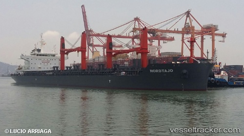
Vessel NORDTAJO IMO: 9741865, MMSI: 255806297 Bulk Carrier
UTC, 28.93887, -95.34201, course: 18, speed: 0
UTC, 28.93833, -95.34167, course: -1, speed: 0
2026-02-12 16:22:43 UTC, 28.93877, -95.34209, course: 18, speed: 0
Live AIS position:
UTC. Near Quintana),
updated 2026-02-12 16:22:43 UTC.
Find the position of the vessel NORDTAJO on the map. The latter are known coordinates and path.
marine traffic ship tracker show on live map
The current position of vessel NORDTAJO is 28.93877 lat / -95.34209 lng. Updated: 2026-02-12 16:22:43 UTCCurrently sailing under the flag of Portugal (MAR)
NORDTAJO built in 2017 year
Deadweight:
38548 tDetails:
Last coordinates of the vessel:
UTC, 28.93890, -95.34202, course: 18, speed: 0UTC, 28.93887, -95.34201, course: 18, speed: 0
UTC, 28.93833, -95.34167, course: -1, speed: 0
2026-02-12 16:22:43 UTC, 28.93877, -95.34209, course: 18, speed: 0