 vesseltracker.com
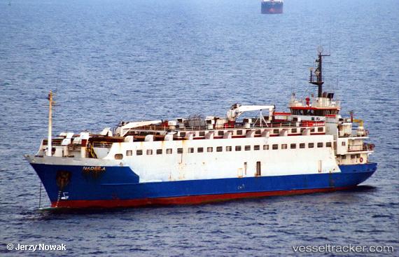
Vessel Nader A IMO: 7611547, MMSI: 671371000 Livestock Carrier
Live AIS position:
UTC. Near Al Latakia),
updated 2025-10-27 07:44:08 UTC.
Find the position of the vessel Nader A on the map. The latter are known coordinates and path.
marine traffic ship tracker show on live map
The current position of vessel Nader A is 35.52145 lat / 35.76303 lng. Updated: 2025-10-27 07:44:08 UTCCurrently sailing under the flag of Togo
Nader A built in 1977 year
Deadweight:
2103 tDetails:
Last coordinates of the vessel:
2025-10-27 07:44:08 UTC, 35.52145, 35.76303, course: -1, speed: 0.2