 vesseltracker.com
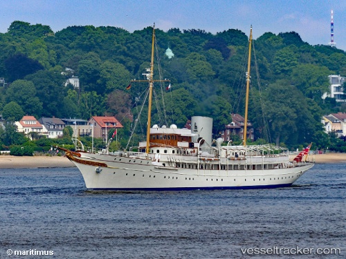
Vessel Nahlin IMO: 1009417, MMSI: 235075032 Yacht
UTC, 17.01345, -61.77051, course: 263, speed: 0
UTC, 17.01345, -61.77051, course: 264, speed: 0.1
2026-02-10 11:57:10 UTC, 16.98915, -61.86301, course: 270, speed: 14.1
Live AIS position:
UTC. Near Falmouth),
updated 2026-02-10 11:57:10 UTC.
Find the position of the vessel Nahlin on the map. The latter are known coordinates and path.
marine traffic ship tracker show on live map
The current position of vessel Nahlin is 16.98915 lat / -61.86301 lng. Updated: 2026-02-10 11:57:10 UTCCurrently sailing under the flag of United Kingdom
Nahlin built in 1930 year
Deadweight:
1574 tDetails:
Last coordinates of the vessel:
UTC, 17.01347, -61.77053, course: 263, speed: 0UTC, 17.01345, -61.77051, course: 263, speed: 0
UTC, 17.01345, -61.77051, course: 264, speed: 0.1
2026-02-10 11:57:10 UTC, 16.98915, -61.86301, course: 270, speed: 14.1